A Visit to Broulee 13-16 April 2021
John Skinner Prout: @Broulee & Illawarra 1841-44 | Australian lithographs 1842-47 | Broulee 2021 |
 |
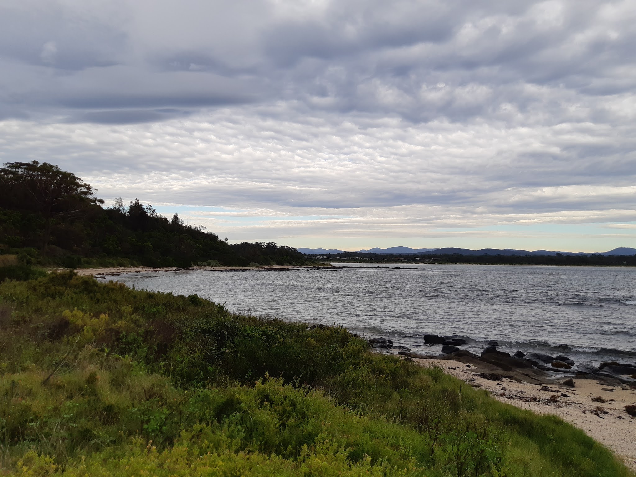
| Sunrise, Broulee Island, view looking north-east, 6.38am, 16 April 2021. |
 |
| John Skinner Prout, Broulee, watercolour on paper, circa 1841 [?1870s]. Collection: State Library of New South Wales. View on the northern side of Broulee Island, looking west towards Broulee Harbour and the township from the small beach below Cornelius O'Brien's Erin-Go-Bragh Inn. |
Skinner Prout's drawing 1841
According to a dated pencil sketch in the Dixson Library collection, State Library of New South Wales, Sydney, during July 1841 visiting English artist John Skinner Prout traveled to Broulee, located one hundred and eighty miles south of Sydney, near the town of Moruya. At the time of Prout's visit, Broulee was the subject of much land speculation, with an attractiveness to investors enhanced by the presence of a secure, though shallow and somewhat exposed harbour - this being a rare commodity along the New South Wales south coast. A subdivision known as 'Boat Harbour' had gone on sale there on 9 January 1840, at the very end of the economic boom period of the late 1830s, and well known Sydney identities such as W.C. Wentworth were amongst the subsequent purchasers of allotments. By July 1841 the development of the port and district of Broulee was proceeding rapidly, spurred on by a brisk sea trade then opening up with Sydney and problems with accessing the entrance of the nearby Moruya River.
Whilst at Broulee, Prout produced a picturesque view in pencil of the inner harbour and headland. This was then worked up into a number of watercolours, whilst in Australia and following his return to England. A version appeared as a steel engraving within E.C. Booth's Australia Illustrated, published in London between 1873-6. Without any more precise records of Prout's visit to Broulee, such as letters or diary notes, we can only guess at the circumstances of his traveling so far from Sydney on this occasion. A study of contemporary shipping records suggests that he most likely traveled there in July on board the brig Trial, under Captain Benton. The journey overland from Sydney would have been long and tedious, whilst there were few sailing or steaming vessels traveling to this isolated coastal settlement at that time. The relative safety of the small harbour encouraged this. We know the Trial departed Sydney for Broulee on 23 July 1841. It was not there long, as it returned to Sydney on the 31st, having put in at Bulli (Illawarra) en route (Broxham & Nicholson, 1988). The fact that only one basic landscape view in pencil of Broulee harbour and headland survives from Skinner Prout's visit there - though with five known variants in watercolour - suggests that his stay may have been very brief.
As an interesting aside, the Trial was owned and operated by Captain Robert Marsh Westmacott, a Sydney businessman and Illawarra settler at Bulli, located on the coast just north of Wollongong. Westmacott was a former Aid-de-camp to Governor Bourke (1831-37), and himself an amateur topographic artist. According to a notice in the Australian newspaper of 9 March 1841, Skinner Prout was then in the process of publishing a lithograph of the Destructive fire at the Albion Mills based on an original drawing taken by Westmacott. Though no copy of this print has yet been located, Skinner Prout did go on to produce a finished version of this work. His painting The Albion Mills on Fire by Moonlight was shown in Sydney during 1847 by then owner John Rae, at the exhibition of the Society for the Promotion of the Fine Arts in Australia. Westmacott and Skinner Prout were most likely acquainted by the time of the artist's excursion to Broulee in July 1841. It is also interesting to note that Robert Marsh Westmacott was born at Sidmouth, Devon, around 1801, while Skinner Prout's own wife Maria Heathilla Marsh (1807-1871) was also from Sidmouth. The possibility of some Marsh family connection between Maria Prout and Captain Westmacott therefore exists. Another possible link with Prout is the fact that in 1838 Westmacott had had published in England a series of six lithographic prints of New South Wales scenes. They were drawn on stone by W. Gauci and printed by the master British lithographer C. Hullmandel, who during that same year produced three volumes of lithographic views of England by Skinner Prout. They were entitled Antiquities of Chester, Antiquities of York, and The Castles and Abbeys of Monmouthshire. It is also possible that Captain Westmacott was one of those in the audience when Skinner Prout presented a series of lectures on 'The Principles and Practice of Painting' in Sydney during December 1841, and may have been host to the artist and his family of a wife and seven children when they visited Illawarra during the Christmas - New Year period of 1843-4, just prior to leaving the Colony for Tasmania.

A walk around Broulee Island, 14 April 2021
[The following is a diary account of a walk around Broulee Island on the morning of Wednesday 14 April 2021. As I noted above, I had never been to Broulee and the island intrigued me, so I was keen to investigate and record via my smartphone Live Transcribe app the immediacy of what I saw and felt that day. It can be seen from the above photograph that the so-called 'island' in fact looks like a peninsula. However, throughout its history, the thin connection to the mainland has been breached by the ocean, thereby isolating the peninsula extension to form an island.]
 |
| Entrance to Broulee Island Nature Reserve, from the western spit, southern side. The track around the edge of the island begins at this point. There did not appear to be a track leading up onto the elevated section of the island. |
8:06 am. 14th of April 2021. I left the family at the Ingenia Holidays Broulee resort and caravan park - some asleep, others awake or waking - with the aim of taking a walk around Broulee Island and seeking out the location of the 1841 drawing by J. Skinner Prout. I set out at 7.42 am and by this point [8.06 am] I have reached the southern extension of the island. It's quite a beautiful day though there is a slightly ominous feeling around me, with a gray cloudy sky and warm breeze blowing to remove the chill of the night. As I stand on the edge of the island, half land and pebbly beach / half volcanic rock shelf, looking out at the ocean and the 270 degree panorama before me, with not a soul around and only the stillness of nature offering any sort of disturbance, the landscape reminds me of a mix between Rarotonga in the Cook Islands - the veritable middle of nowhere with its aquamarine, shallow lagoon and huge ocean waves breaking against it in the distance - plus walking along the cliff between Mcauley's beach and south Thirroul. To be frank, it is a bit scary being alone with the gray clouds above and nearby surf pounding on the black volcanic rocks. There is no one around - just me, birdsong, the land and the sea, though I do like it this way - the mystery and sense of adventure is heightened. The whole island is a nature sanctuary - it has been since 1972 - so the flora and fauna is protected, with little evidence of human intervention along the shoreline. This is their place, and really all I'm doing is walking around the very fringe, in between the land and sea. So that's it, and I am mindful of the sense of time and place that I am feeling. But then I have always been a coastal person, enjoying standing on the edge, where the earth meets the ocean and the sky goes on to eternity in front and above me ....
 |
| Southern side of the Broulee Island, where the land meets the rock platform, with a small strip of eroded rock and rounded pebbles. The blackish volcanic rock platform is relatively thin on this section of the island. It faces the large and energetic ocean swells from the south - swells that are extremely popular with surfboard rides from near and far. |
 |
| Panoramic shot of the eastern edge of Broulee Island with Mossy Point in the distance. There is a wide volcanic rock platform on this side of the island, backed by a thin course sand and pebbly beach, behind which is a small strip of flat land and then a heavily wood cliff face. |
8:12 am. I am walking around the island in an anticlockwise direction, from the south towards the north. I'm now on the eastern side and coming up to my goal, which is to look on the northern shore of the island for the location of the view taken by John Skinner Prout back in July 1841. I have a copy of the view on me and see that it is looking west towards the mountains, but also slightly north to the area that was known as Broulee Harbour and where a ship is seen in the drawing. Back in the day, during the 1830s and 1840s, they could lay at anchor protected by Broulee Island. In 2021 catamarans and private sailing vessels still use this small, protective bay. I am aware of the original black and white pencil sketch by Prout, but also the subsequent beautiful watercolour drawings and the detailed steel engraving. These will help me find the location and perhaps come across a bit of archaeological material, such as rusted iron, wood, clearings, and foreign flora. We shall see.


8:16 am. The area known as Broulee Harbour here in the old days was the big area on the northwestern side of the island, north of the spit which protect it from the southerly swells and provide a relatively safe anchorage. The other one known as Ark Harbour is more of a little landing spot on that northern side of the island - a small cove in between the rocks. It is here that small vessels such as the oar-pulled rowboats seen in Prout's drawing were drawn up onto the shore and cargo or passengers to and from the vessels anchored offshore. So I'm hoping to get to that spot and discover the precise vantage point from where Skinner Prout took his view.
 |
| John Skinner Prout, Broulee, steel engraving, circa 1873. This is a near identical view to the photograph below of Ark Harbour, taken in May 2021. In the drawing, Skinner Prout has exaggerated the height of the cliff in the middle distance and also the one in the left foreground where the Aborigines are seated. |
 |
| Ark Harbour, the small cove on the northern side of Broulee Island and the approximate position of the view taken by John Skinner Prout in July 1841 (above and below). In the foreground is a small raised section of land which forms the eastern edge of the semi-circular sandy beach upon which row boats would draw up in the past. In the left middle ground is the headland upon which the Erin-Go-Bragh hotel stood in the 1840s. In the middle background is Broulee Harbour, backed by the present, low lying town of Broulee, and in the distance mountains. |

8:19 am. Interesting. As I approached the place - a small headland or hill on the side of the cliff where the Aboriginal people in Prout's drawing were sitting - just before that is kind of a sandy, pebbly beach. To the back (behind) that is a small flat sandy area that looks like a bit of a midden. It is covered with grass and bush so it is difficult to tell, though a small section has eroded on the east side and reveals some of the shell-rich fine sediment typical of a coastal Aboriginal midden. Behind this small flat area I can see the cliff. There are of deposits of sandy material in this north eastern section of the island, and a massive amount of shell material.
 |
| Shell-rich pebbly beach, northern eastern side of Broulee Island. |
I have read that this area, and the northern side of the island, was mined for the calcium rich shell material in the past, and I suspect that this is some of the remnant that escaped mining. I also would not be surprised if this is a site extensively used by the local Aboriginal people over the millennia. This northeastern and eastern protected part of the island would be ideal for observing the fish out at sea, acquiring shell fish from the rocky platforms which are not subject to the high energy surf swells to the south, and setting up huts and protective areas below the cliff against exposure to the elements, including cold winds from the south and west. Living and camping on this part of the island was therefore very likely over an extensive period.
8:45 am. I left the caravan park at 7.42 am and it is now 8.45. I am just leaving the island, walking on the split connecting it to the mainland. I found Skinner Prout's site - walked around it, photographed it, and generally took my time in absorbing the sense of place and imaging what it would have been like for the artist here, back in 1841. It was really interesting and basically exactly as he founded it, and drew it,in regards to the landscape. I discovered that it was a mini harbour - Ark Harbour - and a relatively safe area with a small sandy beach for pulling up the row boats. You could see this in the steel engraving and watercolours. It also had a heavily wooded back area where the two small buildings had been.
 |
| Ark Harbour, from the back beach area, looking north towards Tomakin headland. |
----------------------------------
Broulee History [Extract from the Broulee Community Group website 2015+]
There is much evidence that the Yuin people were living around Broulee for thousands of years before European settlement. It is known that they lived mainly on fish and crustaceans and kept with possum skin coats. These stories are still handed down today and Nth Broulee Beach is still fished by local Aboriginal families.
The area was surveyed in 1828 by Thomas Florance who named the district Broulee. By the late 1820s pastoralists had moved into the area. By 1836 the bay on the north side of Broulee Island was a hive of activity loading and unloading sailing boats. It was considered safer than the mouth of the Moruya River where a dangerous sand bar caused difficulties for smaller ships and prevented access by larger ones. It was around this time that John Hawdon wrote to the Governor asking that Broulee be surveyed so he could build a store and jetty so he could ship produce to Sydney.
In 1837 the Surveyor-General advised the Colonial Secretary: "Browlee, which may be called East and West Browlee, being divided in two parts by a narrow neck of sand subject to be overflowed by very high tides, appears not to possess any favourable features for the formation of a town. The harbour is too open and the space for laying out streets is limited ... the place seems too unimportant for any considerable expenditure on the erection of public buildings and without them a town would never be formed." Broulee was surveyed (it included eight streets and 55 blocks on Broulee Island) and gazetted in 1837. Land sales commenced in 1840 with speculators like John Hughes and John Hosking purchasing 1170 acres at the north end of Broulee. They did not attempt to settle in the district and by 1841 they had both gone bankrupt. In 1839 a Police Station was established at Broulee and that same year Broulee became the site of the first court in the Moruya district. At the time there were about 100 convicts under police jurisdiction working on farms in the hinterland. In 1840 a post office was opened. Mail arrived once a week from Braidwood. By 1841 Broulee port was being used by whaling and coastal sailing vessels with as many as six vessels anchored offshore and one local writing "Broulee is becoming daily of greater importance; scarcely a day passes with the arrival or departure of some vessel. In 1841, the schooner Rover, went aground near Candlagan Creek and the crew members were rescued by a group of Yuin people who formed a human chain through the surf. A report in the Sydney Gazette noted: "As the men dropped from her [the Rover] their only chance was to get washed in by the surf within reach of the blacks, who were doing their utmost to save as many as possible, for which they merit great praise". In appreciation Captain William Oldrey presented every member of the tribe with a commemorative brass plate featuring an etching of the ship and an Aboriginal figure. It was also in 1841 that Captain William Oldrey built the district's first hotel on the northern end of Broulee Island. It was named Erin-Go-Bragh (Ireland Forever) and is recognised as the first settlement and first hotel on the far South Coast. In 1841 a flood washed away the sand bar at the mouth of the Moruya River and overnight vessels started sailing up the Moruya River rather than stopping at Broulee.
An abiding problem for Moruya has been the transportation of goods to and from its markets. The delight of the farmers on the Moruya River when the bar at the mouth was washed out in 1841, permitting coastal shipping to use the river, was short lived. It closed over again. For 70 years after they abandoned Broulee Bay as their port the debate raged as to whether they should reopen it or not. A number of alternatives were tried. From time to time coastal shipping did enter the Moruya River and load for the Sydney or interstate markets, but boats were lost on the bar and delays in bad weather were a problem. Smaller boats were tried, to move goods from the river to Bateman's Bay or Nelligen to be re-loaded onto the Illawarra Steamship Company's larger boats traveling regularly to Sydney, but there was the double handling and even for small boats the Moruya bar was dangerous and sometimes impossible. At times goods were hauled to the Clyde over rough tracks and steep hills. Narooma was tried as a port and in 1884 they ran a tramway (it can still be found) from Bodalla to the Wagonga inlet, but it didn't work well. In the 1850's they tried Tuross Lake as a port. One steamer made it through the entrance but was trapped in the Lake for seven weeks when the bar closed over behind it. The 'entrance' to the Lake was there only at times, and it could shift its position dramatically from one tide to the next. A permanent solution to Moruya's problem was not found till road transport became available
In 1851 gold was discovered at Araluen and on smaller creeks between Araluen and Moruya. A new and improved road to Araluen saw Moruya functioning as the region's service centre and the population of Broulee dropped back to a single individual. In 1859 the court, which had been moved from Broulee to Glenduart in 1852, was relocated to Moruya. The Erin-Go-Bragh Hotel was also shifted from Broulee Island to Campbell St, Moruya by Abraham Emmott who opened it as the 'Beehive' store. In 1873 the vegetation on the tombolo (spit of land) between Broulee Island and the mainland was removed to widen the track to the island but, after a particularly violent storm, the sea broke through and the island became ... an island. By 1892 Broulee had effectively been abandoned. In the 1920s shell grit was mined on the northern side of Broulee Island and shipped to Sydney for use in cement production and by 1926 people were starting to buy surveyed blocks of land (they had been surveyed in 1837) in the town and were building holiday shacks. In 1964 all the land on Broulee Island was resumed by the Eurobodalla Shire Council. In 1972 it was declared a Nature Reserve.
----------------------------
Chronology
[The following is a detailed chronology of early references to Broulee, with a focus of the years prior to 1850]
1837
- 31 December: New South Wales Government Gazette - Broulee, Site fixed for and Plan of Township of approved. page 621.
1838
- 19 September: Sydney Monitor - Colonial Treasurer to put up for auction two lots of 1010 and 960 acres at Broulee.
- 13 December: New South Wales Government Gazette - Colonial Secretary's Office, Sydney, Sale of leases of Crown Land at Broulee Harbour to Edward Fletcher Jnr., 640 acres, for yearly rent of £1.0.0. Re-let during 1839.
1839
 |
| Plan of the Village of Broulee 1839. |
- 4 May: New South Wales Government Gazette - Captain William Oldrey, Royal Navy, of Broulee, appointed a magistrate by the governor.
- 11 May: New South Wales Government Gazette - Sale of 640 acres of land at Broulee from the Colonial Secretary's Office, Sydney. Price 5s. per acre.
- 1 June: New South Wales Government Gazette - announcement of forthcoming sale of 1/2 acre town allotments at Broulee. First offered on 15 August.
- 22 June: New South Wales Government Gazette - forthcoming auction of yearly lease of 640 acre lots near Broulee.
- Friday 13 September, The Sydney Monitor and Commercial Advertiser - For Broulee: The fine and fast sailing schooner on her third trip FOX for freight or passage apply to the Master on board at Chapman's Wharf; or to Mr. McMillan, Ship Smith, Windmill Street.
- 30 September: New South Wales Government Gazette - Tender notice for conveyance of mail from and to Braidwood and Broulee once a week.
1841
- Alexander Stewart (1810-1895) former pound-keeper at Wollongong, travels to Broulee to work with Bernhard MacCauley at the Erin-Go-Bragh hotel / inn there (Stewart 1987). He returns to the Illawarra in 1846.
- 16 November: Sydney Morning Herald - letters to the editor by Captain Oldrey of Broulee, including letters by ship captains William Rhodes and J. Stevenson:
Broulee.
To the Editors of the Sydney Herald.
Gentlemen, - I think you will render the public some service by publishing the enclosed letter from Captain Rhode, addressed to me, relative to the Port of Broulee. Mariners might take alarm from the recent loss of the Rover; but the harbour of Broulee should not be condemned on account of her having anchored in the open bay, exposed to a hard gale and heavy sea. Had the Rover been conducted into the harbour, she would have been safe, and the sad catastrophe would have been averted. I hope the ship owners and underwriters will recommend the appointment of a harbour master at this port, frequently six vessels have been at anchor at the same time ¡n our harbour and roads. The inhabitants of Broulee, seeing the necessity of a pilot or harbour master, memorialized the Government, but without success. Captain Stevenson, an able and thorough-bred seaman, would perform the duties for a trifling remuneration.I remain, yours truly,
W.M. Oldrey.
Mount Oldrey, November 7.
Waterloo Warehouse, June 5, 1841. DEAR SIR, - I have just received your communication of this morning, and I hope you will excuse this hasty reply. Broulee is a good road stead for vessels of any size, and is sheltered from all winds except those between about NE. by E. | E. to E., by S. J S., and as it is very rare that hard gales blow in from the eastward, I consider it a safe anchorage. I forget the sounding's and quality of the bottom, having mislaid the chart of the* place which I constructed from my survey in 1834. I was the first person that brought this place into notice; in 1834 I landed from the Harriet, 300 tons burthen, a cargo, and took on board 75 head of cattle; this was all done in ten days. The vessel was anchored off the present town ship, in 3 1/2 fathoms, about 200 yards from the beach; the cattle were hauled alongside from a stockyard by a rope. I need say no more of this place as to its capabilities of shipping cattle or cargo of any description. This road stead is completely sheltered from SE. and southerly winds, which are most to be dreaded on this coast. There is a small cove called Ark Harbour, which is well sheltered from all winds, for small craft ;-depth of water m the middle, I think about two fathoms. I do not think there is a more delightful site for a township in New South Wales, and I once wished to have made this place my home, after retiring from the sea, having put up a large quantity of land in the vicinity, but when it came to auction was outbid. It has always been my opinion that this is the most eligible part to make a road from Argyle, and if that is ever (lone »ill render property about Broulee in valuable. I remain yours truly, W.H. Rhodes. To the Editors of the Sydney Herald.
Gentlemen, - Captain Stevenson is anxious to correct a mistake that has been made, either by Smith, or by one of your amiable "devi's", relative to his opinion of Broulee, Jervis Bay, Twofold Bay, &c. Captain S. considers the above-named road steads and harbours as perfectly safe, and the best ports between Sydney and Corner Inlet. The Rover is much exposed, and had she not been a strong built vessel, she must have gone to pieces long since, the sea makes a clear breach over her at half tide ; the owners, Edye Manning and John Lord, must have lost considerably by her, unless they insured her; nothing of any consequence has been saved since our last communication. We have had a considerable fall of rain, the grass is looking well, and so is the wheat, we shall I hope have about an average crop; reaping will commence in about a month. Shearing has already become general on the coast, although the season has been wet, yet we hope to have a fair clip. Unless more care is taken in securing the letters and newspapers, I shall discontinue to pay tor papers after this quarter, as it is throwing money away upon papers that are illegible from wet and being chafed by the straps. The bag on arriving here on Friday was completely junked, and many persons in consequence of the address on the newspapers being destroyed, received only damaged parts and scraps of news, in lieu of newspapers, the superscription of many letters were in the same state. This has already been reported to the Post Office and I shall for the last time represent our loss to Mr. Raymond. I am not the only person in this quarter who intends to discontinue taking in the public papers, if the evil and loss complained of is not remedied by the Postmaster ordering waterproof bags for our mails. The post is conveyed along the coast, the horse is frequently obliged to swim across the creeks and swamps at the risk of the postman's life and the destruction of the mail. Our letters and papers were never damaged by the old road via Braidwood. Do see to this. I remain, Gentlemen, yours, &c, W.M. Oldrey. To the Editors of the Sydney Herald.
Gentlemen, - I observe in your paper of Tuesday, 26th October, that you have inserted, there is not a safe harbour between the port of Sydney and Corner Inlet. I now beg to state that I never made that assertion, but do consider Twofold Bay, Broulee, and Jervis Bay, as safe harbours at all times for vessels of any tonnage; I consider there are several others of note, but I give preference to the former. - I remain, Gentlemen, your most obedient servant, J. Stevenson.
1844
- Bernard MacCauley returns to Wollongong and leaves the Broulee inn / hotel.
1856
- 30 January, Sydney Morning Herald - Notes of a Voyage to Broulee and a Sojourn in the District.
Leaving Sydney at half-past three p.m., the steamer arrives at Bateman's Bay about one p.m. the following day. Here a brief stay is made, to land passengers, should there happen to be any for this destination, as there were on the present occasion. Bateman's Bay is a wide and capacious inlet, opening to the east, so that as an anchorage it is secure from the influence of the southerly gales. It is studded with islands, or rather, huge heaps of earth, which have all the appearance of islands half-inverted, the whole of the herbage being on one side. Some of the islands lie at the month of the bay, and one or two farther inward are so situated that they almost form a perfect breakwater, inside which vessels might anchor securely in all winds and in every weather. One or two houses are visible on the beach, but there is yet no indication of anything like a township. The coast here, and for a considerable distance on either side, is low, and apparently the country is well grassed, but it is said that the scrub is too dense to allow of the land being readily made available for agricultural purposes.
Passing Bateman's Bay, a couple of hours brings the steamer to Broulee. The harbour here is formed by a bold, far-outstretching headland, which encloses the bay on the northern side, and by an equally bold peninsula on the south. This latter being joined to the main land only by a neck of sand, over which the waves almost meet during a gale, is more frequently called an island. From this small peninsula a ledge of low rocks juts out towards the opposite side of the bay, and forms a natural breakwater, inside of which is the anchorage - a small bay about the size of Sydney Cove. The bay opens to the north-east, but the Heads are in such a position that it is pretty well sheltered from every wind. In 1841 a vessel was wrecked in the harbour, when of twenty-three persons comprising the passengers and crew, eleven were drowned. The gale on the occasion was unprecedented in fierceness, even in tho memory of the oldest blacks. The vessel put in for shelter in a slightly damaged condition, and it is generally said would have been saved, had not the captain refused to comply with the advice of his mate, who knew the harbour, in selecting an anchorage, or had he seen and understood the signals made from the shore, pointing out its position, in which the vessel would lie in safety. Instead of running inside the before-mentioned ledge of rocks, he preferred anchoring towards the middle of the bay, where the vessel was exposed to the full fury of the storm, his impression being that there was not sufficient water in the position indicated. At first sight this impression would appear to have been very natural, the water, owing to the gently sloping appearance which the beach presents, having a shallow aspect, All the people here, however, agree in stating that vessels as large as that which was wrecked - a schooner - have anchored in the cove, so near the shore that those On board could converse with persons on the beach. The painful circumstances attending the wreck in question are still vividly and minutely related by many of the inhabitants here. It appears that the vessel struck the shore, but, owing to the fearful surf which was rolling, was not sufficiently near to allow of the lives of those on board being saved otherwise than by the greatest exertion. The masts and spars giving way one by one, those On board were exposed to death in two shapes-death by being crushed by the falling timbers if they remained on the deck, and death by drowning if they trusted themselves to the waves. The blacks, who were then numerous hereabouts, lent valuable assistance in saving those who escaped. Forming themselves into chain by uniting hand to hand, one of the number approached the wreck as closely as possible, and grappled such of the shipwrecked people as had sufficient courage to leap over the boom. Most of those who escaped were saved in this manner ; but nearly all came ashore in a senseless state, those who revived owing their lives in a great degree to the attention of the inhabitants, who lighted a large fire on the beach, before which they placed the bodies as they came ashore, while they adopted the necessary means to aid resuscitation.
There are three buildings at Broulee, neither of which are at present tenanted. Two of these are a court-house and a lock-up, erected here some years since, when it was contemplated establishing an extensive township at and a large private dwelling. A flag-staff, apparently long disused, surmounts the southern headland, and indicates the position of the harbour from a distance. No freight is taken in or discharged at Broulee at the present time. The steamer merely calls to land passengers or take them on board, as the case may be. The craft trading to and from Moruya frequently anchor in the harbour, sometimes for a purpose similar to that which brings the steamer, but more generally to wait for a favourable wind.
Around the site of the court-house and lock-up previously mentioned a considerable quantity of land was marked off and sold as a township, in 1840 or'41. The project of the township originated with Captain Oldrey, and hence to the present day the place is known by the name of " Oldrey's Folly," the failure of the project having already been made sufficiently apparent. The cause of the blight which fell upon the prospects of the seaport town, commenced with so much spirit, is said to be the barrenness of the land in tho immediate vicinity of the bay, and the absence of an abundant supply of fresh water. For three miles into the interior the land is chiefly of a sandy quality, and the only fresh water on the shore is to be found in a spring which is covered by the sea at high tide. The real cause of the failure is more probably to be found in the successful competition of the Moruya as a port with the harbour of Broulee. Not only does the former present a better anchorage for small vessels, but the superior advantages which the river presents for the conveyance of produce to the shipping would almost, under any circumstances, point out its banks as the proper seat for the settlement. Under other circumstances there can be little doubt but that Broulee would have become a place of considerable importance, and thus, although complaints are made about " land being sold, which proved to be nothing but sand," it does not appear to me that much, if any, blame attaches to any one in the matter. Up to the time of laying out the township, it moreover appears, most of the produce of the district was shipped at Broulee.
From the landing place a journey of nine miles brings the traveller to the town of Moruya, that is, provided he take the direct road, which lies immediately behind the old buildings. If he be a stranger in this district, however, and unaccompanied by a guide, and should happen to choose another road, he may travel fifteen, or even twenty miles, before he reaches the nearest inn, the Currency Lass, kept by Mr. Harper, situate about seven miles from the beach. As before mentioned, the country for about three miles round is sandy, but well grassed, and covered with scrub. Subsequently the soil becomes black, and the country begins to present every indication of the greatest fertility. Numerous farms and comfortable-looking dwellings are frequently met with. Agriculture is the principal if not the only pursuit in the district. The dairy is comparatively neglected, the settlers contenting themselves with the milk and butter necessary for their own use. Wheat, maize, and potatoes are the chief products cultivated. The wheat of the present season is for the most part gathered in, and the maize and potatoes are presenting an excellent appearance. The wheat crop will, I am told, yield on an average thirty bushels per acre, and the quantity grown in the district may be estimated by the fact that 9000 bushels are to be thrashed at one machine. Smut has not even made its appearance. Notwithstanding the abundance of the season good prices are expected, and purchasers are said to have already made good offers.
In travelling through the Broulee district, the fact presents itself strikingly, that although it has long been regarded as, and is unquestionably, one of the finest agricultural districts in the country, but comparatively little of the land has as yet been brought under cultivation. This state of things is encouraging to embryo agriculturists. Moat of the settlers here are lessees, or yearly tenants, and the general prosperity which they enjoy, and the contentment which they manifest, only the more strikingly illustrate how favoured in the district in the possession of the best natural advantages. The Moruya, its town, harbour, and adjacent country, will be treated of on another occasion.
Viator. Moruya, 22nd January, 1856.
-------------------------
References
Ballard, P., Coastal Change at Broulee 1828 - 1981: the cartographic evidence, Monograph No. 12, 1982, Royal Military College, Duntroon, ACT and Department of Geography, University of New South Wales.
Bayley, W.A., Behind Broulee, Central South Coast, New South Wales, Eurobodalla Shire Council, Moruya, 1973.
Booth, E.C., Australia Illustrated, 2 volumes, Virtue & Co., London, 1873-76.
----, Early Sydney Engravings, (Facsimile reprint of sections of Australia Illustrated), Sydney Ure Smith, Sydney, 1975.
----, Australia in the 1870s, (Facsimile reprint of Australia Illustrated), Summit Books, Dee Why, 1976, 232p.
Brown, Tony, John Skinner Prout - A Colonial Artist, Art and Australia, vol.22, no.4, Winter, 1985, pp.516-22.
----, John Skinner Prout, in Joan Kerr (ed), Dictionary of Australian Artists to 1870, Oxford University Press, Melbourne, 1992.
Brown, Tony and Hendrik Kolenberg, Skinner Prout in Australia, 1840-48, Tasmanian Museum & Art Gallery, Hobart, 1986, 80p.
Broxham, G. and I. Nicholson, Shipping Arrivals and Departures, Sydney, 1841-1844, Roebuck, Canberra, 1988, 483p.
Broulee History, in The Nature Coast of NSW - from Durras to The Tilbas [webpage], South Coast Travel Guide. Viewed 17 April 2021.
Broulee Island - Enviro treasure hunt [leaflet], Yumpu, Eurobodalla Shire Council, 2013.
Broulee Island Nature Reserve: Plan of Management, National Parks and Wildlife Service, New South Wales Department of the Environment and Climate Change July 2008, 22p.
Cantle, Andrea, More than 50 sharks spotted off NSW coast, The Young Witness, 16 November 2020.
Coghlan, I.R., Short, A.D., Carley, J.T., Harrison, A.J., Vos, K., Lenehan, N. and Wiecek, D., Broulee: An island no more?, Proceedings of the 19th NSW Coastal Conference, 2018, 17p.
Coghlan, I.R., Carley, J.T., Harrison, A.J., Howe, D., Short, A.D., Ruprecht, J.E., Flocard, F. and Rahman, P.F., Eurobodalla Coastal Hazard Assessment, Water Research Laboratory Technical Report 2017/09, Final, October 2017.
Ind, Martin, Broulee Lookout, Beach and Island [webpage], Storylines - Yuin Moruya Community, 2006.
McLean, R.F., Shen, J. and Thom, B.W., Beach Change at Bengello Beach,Eurobodalla Shire, New South Wales: 1972-2010, Proceedings of the 27th NSW Coastal Conference, 2018.
Nelson, Jenny, Timmis, Lynette and Fisher, Richard (editors), Broulee Bay Folklore, Myth & Legend [blog], April 2015+, Broulee Mossy Point Community Association. The most comprehensive online history of Broulee.
Oliver, T.S.N., Dougherty, A.J., Gliganic, L.A. and Woodroffe, C.D., Towards more robust chronologies of coastal progradation: optically stimulated luminescence ages for the coastal plain at Moruya, south-eastern Australia, The Holocene, 25, 2015, 536-546.
Regional State of the Environment Report 2004-2009 - Eurobodalla - Heritage [webpage], ACT Government, Canberra, 2009. Broulee Island is listed on the Register of the National Estate.
Stewart, Alexander, Reminiscences of Alexander Stewart, Illawarra Historical Publications, 1987, 51p.
Sullivan, M.E., Exploitation of offshore island along the New South Wales coastline, Australian Archaeology, 15, December 1982, 8-19.
John Skinner Prout: @Broulee & Illawarra 1841-44 | Australian lithographs 1842-47 | Broulee 2021 |
Last updated: 12 September 2021
Michael Organ, Australia (Home)


Comments
Post a Comment